Mapping
Throughout history, maps have proven to stand the test of time. Today is no different, as maps are imperative when it comes to buying or selling a property. We pride ourselves in our mapping abilities, and utilize satellite and drone mapping to give accurate portrayals of what each property looks like.
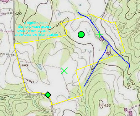
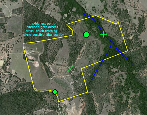
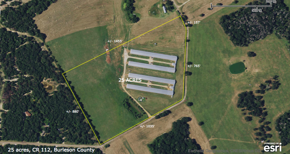
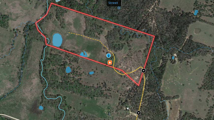
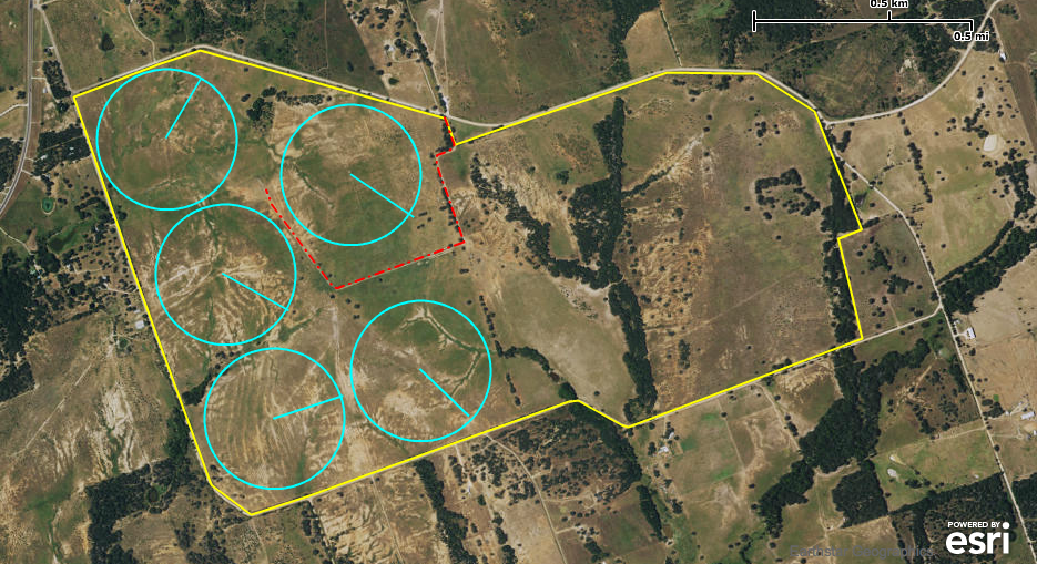
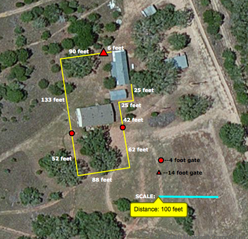
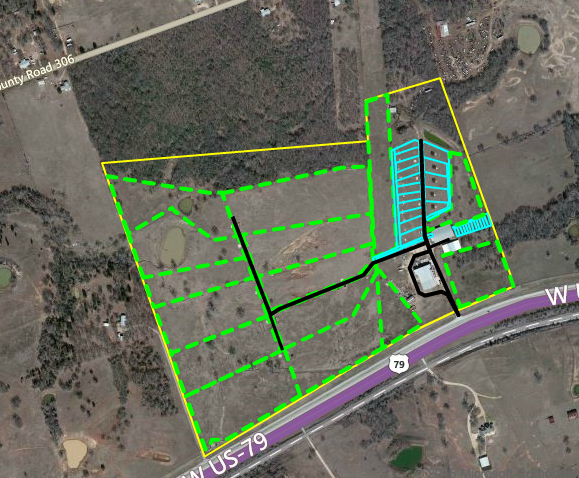
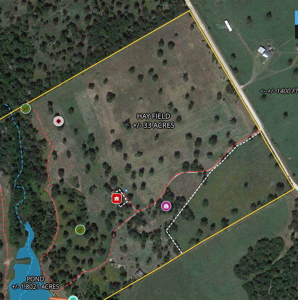
SATELLITE MAPPING
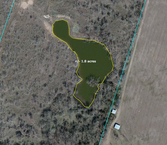
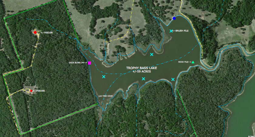
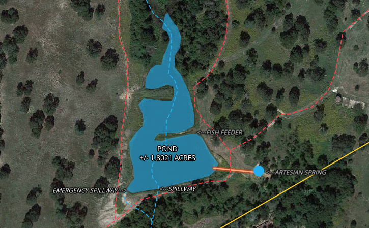
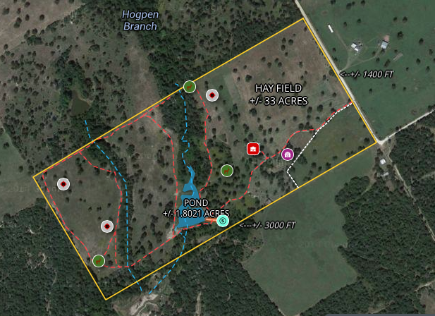
Satellite mapping utilizes data that is stored online from providers such a Google Maps. These maps of a two-dimensional look and will help to outline boundaries as well as mark any improvements, or other points of interest. We use standard satellite images, and topographical maps for all of mapping projects.
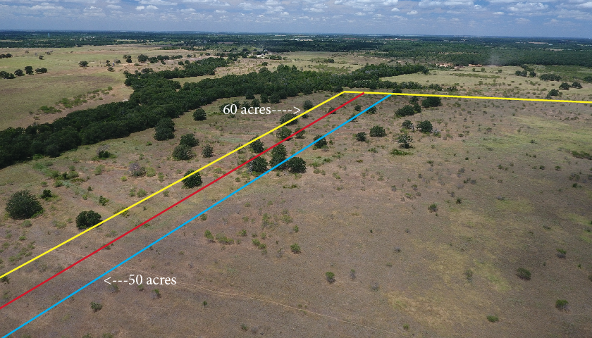
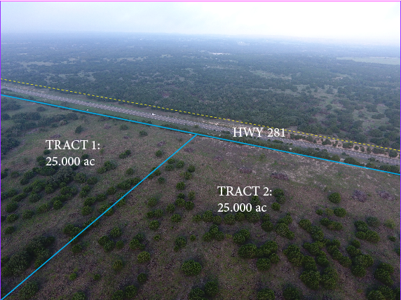
We can use mapping programs to measure distances & acreages, which help to determine fencing, distances to power/water, pond sizes etc.
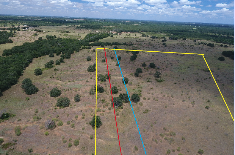
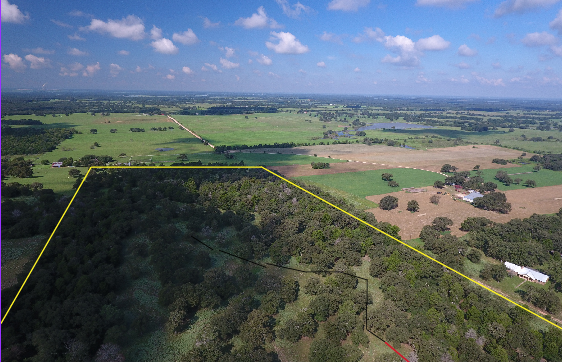
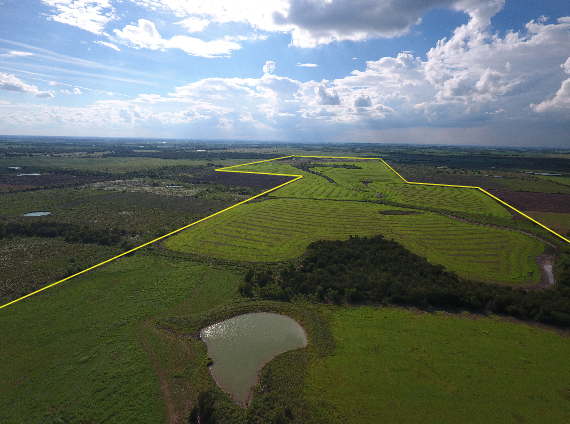
DRONE MAPPING
Drone mapping is a new way to get an up-to -date look at a property while also adding in a third dimension. This allows for buyers and sellers to get a realistic view rather than the typical straight-down aerial shot. This type of mapping works very well when the property is very wooded, and also on properties that are being cut into smaller tracts. Roads, homes, and other improvements can be labeled as well.